Karşıyaka (Karşıyaka İlçesi)
Karşıyaka is a district of İzmir Province in Turkey. The district extends for twelve kilometres along the northern and eastern coastline of the tip of the Gulf of İzmir. Its centre is at a distance of 6 km to the north from the traditional centre of İzmir, which is Konak Square in Konak at the opposite coast. Karşıyaka's district area neighbours the district areas of Menemen to the north, Bornova to the east and Çiğli to the west. Besides being an active venue of commerce, culture and educational activities and tourism, Karşıyaka also has an urban culture centred on the sports club Karşıyaka SK, which commands a large and passionate fan base.
Late created formations around Izmir consist of sandstone, shale and limestone blocks some of which may be larger than several kilometers. Such formations which are generally observed on hills around the region, are the main reasons for resistance on the hills. In addition to these, the community of neogen age can easily be estimated through the andesitic compounds of volcanic origin, around Mount Yamanlar. Such units can be listed as silisium, aluminum, sodium, lava with magnesium content, tuff and tuff stuffed lava agglomerates. The lava also contains reddish brown and greenish gray large feldspar crystals. Neogen sedimentary rocks are made up of clay stone, sandstone and pebble stones at dept while being made up only of limestone on the top. At some places clay stone is observed on limestone layers. It is possible to say that ground resistance is satisfactory in regions covered with limestone on top, while ground resistance is low in regions which has thin layers of limestone intercalated with mud rocks.
Late created formations around Izmir consist of sandstone, shale and limestone blocks some of which may be larger than several kilometers. Such formations which are generally observed on hills around the region, are the main reasons for resistance on the hills. In addition to these, the community of neogen age can easily be estimated through the andesitic compounds of volcanic origin, around Mount Yamanlar. Such units can be listed as silisium, aluminum, sodium, lava with magnesium content, tuff and tuff stuffed lava agglomerates. The lava also contains reddish brown and greenish gray large feldspar crystals. Neogen sedimentary rocks are made up of clay stone, sandstone and pebble stones at dept while being made up only of limestone on the top. At some places clay stone is observed on limestone layers. It is possible to say that ground resistance is satisfactory in regions covered with limestone on top, while ground resistance is low in regions which has thin layers of limestone intercalated with mud rocks.
Map - Karşıyaka (Karşıyaka İlçesi)
Map
Country - Turkey
 |
|
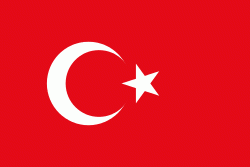
| Flag of Turkey | |
One of the world's earliest permanently settled regions, present-day Turkey was home to important Neolithic sites like Göbekli Tepe, and was inhabited by ancient civilisations including the Hattians, Hittites, Anatolian peoples, Mycenaean Greeks, Persians and others. Following the conquests of Alexander the Great which started the Hellenistic period, most of the ancient regions in modern Turkey were culturally Hellenised, which continued during the Byzantine era. The Seljuk Turks began migrating in the 11th century, and the Sultanate of Rum ruled Anatolia until the Mongol invasion in 1243, when it disintegrated into small Turkish principalities. Beginning in the late 13th century, the Ottomans united the principalities and conquered the Balkans, and the Turkification of Anatolia increased during the Ottoman period. After Mehmed II conquered Constantinople (Istanbul) in 1453, Ottoman expansion continued under Selim I. During the reign of Suleiman the Magnificent, the Ottoman Empire became a global power. From the late 18th century onwards, the empire's power declined with a gradual loss of territories. Mahmud II started a period of modernisation in the early 19th century. The Young Turk Revolution of 1908 restricted the authority of the Sultan and restored the Ottoman Parliament after a 30-year suspension, ushering the empire into a multi-party period. The 1913 coup d'état put the country under the control of the Three Pashas, who facilitated the Empire's entry into World War I as part of the Central Powers in 1914. During the war, the Ottoman government committed genocides against its Armenian, Greek and Assyrian subjects. After its defeat in the war, the Ottoman Empire was partitioned.
Currency / Language
| ISO | Currency | Symbol | Significant figures |
|---|---|---|---|
| TRY | Turkish lira | ₺ | 2 |
| ISO | Language |
|---|---|
| AV | Avar language |
| AZ | Azerbaijani language |
| KU | Kurdish language |
| TR | Turkish language |


